Canton d'Oosterland : Différence entre versions
Un article de WikiSimland 3.0.
(Page créée avec « {| class="toc" style="float: right; width: 23em; font-size: 95%; text-align: left; margin-left:1em; vertical-align:top;" |- | colspan="2" align="center" valign="middle" h... ») |
|||
| Ligne 50: | Ligne 50: | ||
|- | |- | ||
|} | |} | ||
| + | |||
| + | {{Modèle:Infobox Canton d'Oosterland}} | ||
La '''République et Canton d'Oosterland''' (OS - en néerlandais Kanton Oosterland) est un canton de l' [[État hudsonois]] dont la langue officielle est le néerlandais. Son chef-lieu est [[Kasteelheer]]. | La '''République et Canton d'Oosterland''' (OS - en néerlandais Kanton Oosterland) est un canton de l' [[État hudsonois]] dont la langue officielle est le néerlandais. Son chef-lieu est [[Kasteelheer]]. | ||
Version du 22 novembre 2013 à 13:11
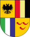
| Canton d'Oosterland Kanton Oosterland | |
 
| |
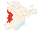
| Localisation | |
| Administration | |
| Pays | Simland |
| Nom | République et Canton d'Oosterland |
| Abréviation | OS |
| Chef-lieu | Kasteelheer |
| Communes | 17 |
| Districts | 3 |
| Président | François Den Blidden |
| Géographie | |
| Population | 78.340 habitants |
| Superficie | 567,78 km² |
| Densité | 137,97 hab/km² |
| Langue | Néerlandais |
| Gentilé | Oostlandais,aise |
| République et canton d'Oosterland | |
|---|---|
| Republiek en Kanton Oosterland (nl) Republic and Canton of Westland (en) | |
 
| |
| Drapeau Localisation | |
| Administration | |
| Etat | |
| Abréviation | OS |
| Langues officielles | Néerlandais Anglais |
| Capitale | Kasteelheer |
| Districts | ?? |
| Communes | 75 |
| Exécutif | ?? |
| Législatif | ?? |
| Conseil national | 13 sièges |
| Conseil des cantons | 2 sièges |
| Démographie | |
| Population | 561 340 hab. |
| Densité | 27.5 hab./km² |
| Gentilé | Oostlandais, Oostlandaise |
| Rang | ?? |
| Géographie | |
| Superficie | 20 399 km² |
| Rang | ?? |
La République et Canton d'Oosterland (OS - en néerlandais Kanton Oosterland) est un canton de l' État hudsonois dont la langue officielle est le néerlandais. Son chef-lieu est Kasteelheer.