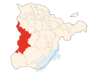
Modèle:Infobox Canton d'Oosterland : Différence entre versions
Un article de WikiSimland 3.0.
| (Une révision intermédiaire par un autre utilisateur non affichée) | |||
| Ligne 5: | Ligne 5: | ||
| colspan="2" align="center" | <font size="2">Republiek en Kanton Oosterland (nl)<br/>Republic and Canton of Westland (en)<br/> | | colspan="2" align="center" | <font size="2">Republiek en Kanton Oosterland (nl)<br/>Republic and Canton of Westland (en)<br/> | ||
|- | |- | ||
| − | | colspan="2" align="center" |[[Image: | + | | colspan="2" align="center" |[[Image:BlasonOst.png|80px]] [[Image:CarteOS-HR.png|130px]] |
|- | |- | ||
| colspan="2" align="left" | <font size="1.5"> Drapeau Localisation | | colspan="2" align="left" | <font size="1.5"> Drapeau Localisation | ||
| Ligne 35: | Ligne 35: | ||
| <font color=#000000>'''Population'''</font color> || align="left" | 561 340 hab. | | <font color=#000000>'''Population'''</font color> || align="left" | 561 340 hab. | ||
|- | |- | ||
| − | | <font color=#000000>'''Densité'''</font color> || align="left" | 27. | + | | <font color=#000000>'''Densité'''</font color> || align="left" | 27.5 hab./km² |
|- | |- | ||
| <font color=#000000>'''Gentilé'''</font color> || align="left" | Oostlandais, Oostlandaise | | <font color=#000000>'''Gentilé'''</font color> || align="left" | Oostlandais, Oostlandaise | ||
Version actuelle en date du 25 novembre 2013 à 20:47
| République et canton d'Oosterland | |
|---|---|
| Republiek en Kanton Oosterland (nl) Republic and Canton of Westland (en) | |
 
| |
| Drapeau Localisation | |
| Administration | |
| Etat | |
| Abréviation | OS |
| Langues officielles | Néerlandais Anglais |
| Capitale | Kasteelheer |
| Districts | ?? |
| Communes | 75 |
| Exécutif | ?? |
| Législatif | ?? |
| Conseil national | 13 sièges |
| Conseil des cantons | 2 sièges |
| Démographie | |
| Population | 561 340 hab. |
| Densité | 27.5 hab./km² |
| Gentilé | Oostlandais, Oostlandaise |
| Rang | ?? |
| Géographie | |
| Superficie | 20 399 km² |
| Rang | ?? |