Département de la Pointe Méridionale : Différence entre versions
Un article de WikiSimland 3.0.
(Page créée avec « {| class="toccolours" style="float:right;margin: 0em 0em 0em 1em;" |- ! colspan="2" align="center" valign="middle" height="40" style="font-weight: bold; font-size: 1em; ba... ») |
M (Pointe Méridionale déplacé vers Département de la Pointe Méridionale) |
||
| (10 révisions intermédiaires par 3 utilisateurs non affichées) | |||
| Ligne 1: | Ligne 1: | ||
| − | {| class="toccolours" style="float:right;margin: 0em 0em 0em 1em;" | + | [[Image:Meridionie.PNG|center]] |
| + | |||
| + | |||
| + | {| class="toccolours" width="285" style="float:right;margin: 0em 0em 0em 1em;" | ||
|- | |- | ||
| − | ! colspan="2" align="center" valign="middle" height=" | + | ! colspan="2" align="center" valign="middle" height="38" style="font-weight: bold; font-size: 1em; background: #002d40; color: #ffffff" | <font size="3.5">'''Département de la Pointe Méridionale'''<br/> <font size="1">'' ''</font size> |
|- | |- | ||
| − | | colspan="2" align="center" | | + | | colspan="2" align="center" | <font size="2">Samarr-Larmq katfe (tabeuneck)<br/> |
|- | |- | ||
| − | | | + | | colspan="2" align="center" |[[Image:|80px]] [[Image:DPTS_PM_MD.png|130px]] |
| − | | | + | |
| − | + | ||
|- | |- | ||
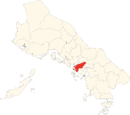
| − | | | + | | colspan="2" align="left" | <font size="1.5"> Drapeau Localisation |
|- | |- | ||
| − | | <font | + | ! colspan="2" align="center" valign="middle" height="13" style="font-weight: bold; font-size: 1em; background: #002d40; color: #ffffff" | <font size="2">'''Administration''' |
|- | |- | ||
| − | + | | '''[[Etat]]''' || align="left" | [[Image:Drapeau-Empire-Méridional.png|20px]] [[Méridionie]] | |
|- | |- | ||
| − | | <font color=# | + | | <font color=#000000>'''Abréviation'''</font color> || align="left" | PM |
|- | |- | ||
| − | | <font color=# | + | | style="vertical-align: top;" | <font color=#000000>'''Langue régionale'''</font color> || align="left" | Tabeuneck et Français |
|- | |- | ||
| − | + | | <font color=#000000 >'''Chef-lieu'''</font color> || align="left" | [[...]] | |
|- | |- | ||
| − | |<font color=# | + | | <font color=#000000 >'''Président<br>départemental'''</font color> || align="left" | ?? |
|- | |- | ||
| − | |<font color=# | + | | <font color=#000000 >'''circonscriptions'''</font color> || align="left" | 18 |
|- | |- | ||
| − | |<font color=# | + | | <font color=#000000 >'''Cantons'''</font color> || align="left" | ?? |
|- | |- | ||
| − | |<font color=# | + | | <font color=#000000 >'''Communes'''</font color> || align="left" | ?? |
|- | |- | ||
| − | |<font color=# | + | | <font color=#000000 >'''Ass. Prem. Nat.'''</font color> || align="left" | ?? sièges |
|- | |- | ||
| − | ! colspan="2" align="center" valign="middle" height="20" style="font-weight: bold; font-size: 1em; background: # | + | ! colspan="2" align="center" valign="middle" height="20" style="font-weight: bold; font-size: 1em; background: #002d40; color: #ffffff" | <font size="2">'''Démographie''' |
|- | |- | ||
| − | ! colspan="2" align="center" | + | | <font color=#000000>'''Population'''</font color> || align="left" | ?? hab. |
| + | |- | ||
| + | | <font color=#000000>'''Densité'''</font color> || align="left" | ?? hab./km² | ||
| + | |- | ||
| + | | <font color=#000000>'''Gentilé'''</font color> || align="left" | Pointois, Pointoise | ||
| + | |- | ||
| + | ! colspan="2" align="center" valign="middle" height="20" style="font-weight: bold; font-size: 1em; background: #002d40; color: #ffffff" | <font size="2">'''Géographie''' | ||
| + | |- | ||
| + | |<font color=#000000>'''Superficie'''</font color>|| align="left" | ?? km² | ||
| + | |- | ||
| + | |<font color=#000000>'''Lieux remarquables'''</font color> || align="left" | ?? | ||
| + | |- | ||
| + | | <font color=#000000 >'''Ressources principales'''</font color> || align="left" | ?? | ||
|- | |- | ||
| − | |||
|} | |} | ||
| − | |||
| − | + | [[Ancien article du département de la Pointe Méridionale]] | |
| + | |||
| + | |||
{{Départements du Simland Méridional}} | {{Départements du Simland Méridional}} | ||
| − | {{ | + | {{Bande Portail Méridionie}} |
| − | + | ||
| − | + | ||
Version actuelle en date du 6 avril 2014 à 17:38
| Département de la Pointe Méridionale | |
|---|---|
| Samarr-Larmq katfe (tabeuneck) | |
[[Image:|80px]] 
| |
| Drapeau Localisation | |
| Administration | |
| Etat | |
| Abréviation | PM |
| Langue régionale | Tabeuneck et Français |
| Chef-lieu | ... |
| Président départemental |
?? |
| circonscriptions | 18 |
| Cantons | ?? |
| Communes | ?? |
| Ass. Prem. Nat. | ?? sièges |
| Démographie | |
| Population | ?? hab. |
| Densité | ?? hab./km² |
| Gentilé | Pointois, Pointoise |
| Géographie | |
| Superficie | ?? km² |
| Lieux remarquables | ?? |
| Ressources principales | ?? |
Ancien article du département de la Pointe Méridionale
| |
Départements et préfectures de Méridionie | |
|---|---|---|
| Départements : | Apach • Arran • Artis • Artyrien • Assure • Astars • Bouches-de-l'Oméga • Châteldon • Centre Méridional • Ckrystahal • Côte d'Azur • Côte d'Opale • Haute Opik • Kalosie • Kolines • Korazane • Lac Oméga • Marastar • Méridional Intérieur • Méridional Maritime • Mérydile • Oméga • Oméga Inférieur • Opik • Piedmont • Pointe Méridionale • Psylone • Territoire des Qcristos • Ruscovitie • Vergar • Yatupek | |
| Préfectures : | | |
| Anciens : | West State County • New Clark County • Oblast de Tanaziof • Hirohito |
| |
|---|
