District of Columbia : Différence entre versions
Un article de WikiSimland 3.0.
(Annulation des modifications 67923 de SGJason (discussion)) |
|||
| (15 révisions intermédiaires par 2 utilisateurs non affichées) | |||
| Ligne 16: | Ligne 16: | ||
! colspan="2" align="center" valign="middle" height="20" style="font-weight: bold; font-size: 1em; background: #1fA055; color: #ffffff" | <font size="2">'''Administration''' | ! colspan="2" align="center" valign="middle" height="20" style="font-weight: bold; font-size: 1em; background: #1fA055; color: #ffffff" | <font size="2">'''Administration''' | ||
|- | |- | ||
| − | | <font color=#3265fd>'''Chef-lieu'''</font color> || align="center" | [[Sonoma DC]] | + | | <font color=#3265fd>'''Chef-lieu'''</font color> || align="center" | [[Sonoma DC]] |
| + | |- | ||
| + | | <font color=#3265fd>'''Compté'''</font color> || align="center" | [[Sonoma County]] - [[Toluca County]] - [[Fairview County]] - [[Hill Valley County]] | ||
|- | |- | ||
! colspan="2" align="center" valign="middle" height="20" style="font-weight: bold; font-size: 1em; background: #1fA055; color: #ffffff" | <font size="2">'''Données statistiques et géographiques''' | ! colspan="2" align="center" valign="middle" height="20" style="font-weight: bold; font-size: 1em; background: #1fA055; color: #ffffff" | <font size="2">'''Données statistiques et géographiques''' | ||
|- | |- | ||
| − | |<font color=#3265fd>'''Superficie'''</font color> || align="center" | | + | |<font color=#3265fd>'''Superficie'''</font color> || align="center" | 2241 km2 |
|- | |- | ||
| − | |<font color=#3265fd>'''Gentilé'''</font color>|| align="center" | | + | |<font color=#3265fd>'''Gentilé'''</font color>|| align="center" | Columbien |
|- | |- | ||
| − | |<font color=#3265fd>'''Population'''</font color> || align="center" | | + | |<font color=#3265fd>'''Population'''</font color> || align="center" | 18 494 208 hab. |
|- | |- | ||
| − | |<font color=#3265fd>'''Densité'''</font color> || align="center" | | + | |<font color=#3265fd>'''Densité'''</font color> || align="center" | 8252 hab/km2 |
|- | |- | ||
| − | |<font color=#3265fd>'''Villes importantes'''</font color> || align="center" | [[Sonoma DC]] | + | |<font color=#3265fd>'''Villes importantes'''</font color> || align="center" | [[Sonoma DC]] - [[Fairview]] - [[Oakdale DC]] - [[Hill Valley]] |
| − | + | ||
| − | + | ||
| − | + | ||
| − | + | ||
|- | |- | ||
! colspan="2" align="center" valign="middle" height="20" style="font-weight: bold; font-size: 1em; background: #1fA055; color: #ffffff" | <font size="2">'''Carte'''</font size> | ! colspan="2" align="center" valign="middle" height="20" style="font-weight: bold; font-size: 1em; background: #1fA055; color: #ffffff" | <font size="2">'''Carte'''</font size> | ||
|- | |- | ||
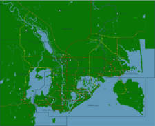
| − | ! colspan="2" align="center" | | + | ! colspan="2" align="center" | [[Image:Sonomametromapsmall.png|225px]] |
|} | |} | ||
| + | Le [[District de Columbia]] est un district de la région de [[Génésie]], au nord du Grand Lac Salé. Ses villes principales sont [[Sonoma]] (le chef lieu), [[Fairview]], [[Oakdale DC]] et [[Hill Valley]]. C'est le distric le plus peuplé de [[Columbia]] et de l'état Génésiens. La population totale du District de Columbia est de 18 494 208 habitants. | ||
| + | |||
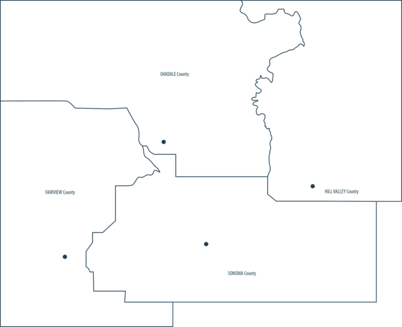
| + | [[Image:Districtcolumbia.png|800px]] | ||
| + | <center> | ||
| + | {| class="wikitable alternance centre" width="800" | ||
| + | |+ Données Statistiques | ||
| + | |- | ||
| + | | | ||
| + | ! scope="col" | Population | ||
| + | ! scope="col" | Taille | ||
| + | ! scope="col" | Densité | ||
| + | |- | ||
| + | ! scope="row" | [[Sonoma County]] | ||
| + | | 10 245 208 hab | ||
| + | | 384 km2 | ||
| + | | 26 680 hab / km2 | ||
| + | |- | ||
| + | ! scope="row" | [[Toluca County]] | ||
| + | | 455 652 hab | ||
| + | | 865 km2 | ||
| + | | 526 hab / km2 | ||
| + | |- | ||
| + | ! scope="row" | [[Fairview County]] | ||
| + | | 1 945 672 hab | ||
| + | | 480 km2 | ||
| + | | 4053 hab / km2 | ||
| + | |- | ||
| + | ! scope="row" | [[Hill Valley County]] | ||
| + | | 5 846 289 hab | ||
| + | | 512 km2 | ||
| + | | 11 418 hab / km2 | ||
| + | |- | ||
| + | ! scope="row" | Total | ||
| + | | 18 494 208 hab | ||
| + | | 2241 km2 | ||
| + | | 8252 hab / km2 | ||
| + | |} | ||
| + | </center> | ||
| − | + | {{SonomaDC}} | |
| − | |||
{{Lien districts génésie}} | {{Lien districts génésie}} | ||
| Ligne 48: | Ligne 83: | ||
[[Catégorie:Génésie]] | [[Catégorie:Génésie]] | ||
| − | [[catégorie: | + | [[catégorie:District of Columbia]] |
Version actuelle en date du 2 février 2013 à 02:08
| District of Columbia | |
|---|---|
| Pays | Simland |
| Région/Etat | Génésie (GE) | 08 |
| Langue majoritaire | Anglais |
| Autres langues courantes | Français, Espagnol, Simlish. |
| Administration | |
| Chef-lieu | Sonoma DC |
| Compté | Sonoma County - Toluca County - Fairview County - Hill Valley County |
| Données statistiques et géographiques | |
| Superficie | 2241 km2 |
| Gentilé | Columbien |
| Population | 18 494 208 hab. |
| Densité | 8252 hab/km2 |
| Villes importantes | Sonoma DC - Fairview - Oakdale DC - Hill Valley |
| Carte | |

| |
Le District de Columbia est un district de la région de Génésie, au nord du Grand Lac Salé. Ses villes principales sont Sonoma (le chef lieu), Fairview, Oakdale DC et Hill Valley. C'est le distric le plus peuplé de Columbia et de l'état Génésiens. La population totale du District de Columbia est de 18 494 208 habitants.
| Population | Taille | Densité | |
|---|---|---|---|
| Sonoma County | 10 245 208 hab | 384 km2 | 26 680 hab / km2 |
| Toluca County | 455 652 hab | 865 km2 | 526 hab / km2 |
| Fairview County | 1 945 672 hab | 480 km2 | 4053 hab / km2 |
| Hill Valley County | 5 846 289 hab | 512 km2 | 11 418 hab / km2 |
| Total | 18 494 208 hab | 2241 km2 | 8252 hab / km2 |
| Districts de Génésie | |
|---|---|
| Génésie Centrale (01) • Hanovrie (02) • Méridionie (03) • Salendrie (04) • Génésie Supérieure (05) • Carolie (06) • Basse Génésie (07) • Oakland District (08) |
