Salendrie : Différence entre versions
Un article de WikiSimland 3.0.
(→Les volcans) |
|||
| (4 révisions intermédiaires par 2 utilisateurs non affichées) | |||
| Ligne 3: | Ligne 3: | ||
! colspan="2" align="center" valign="middle" height="40" style="font-weight: bold; font-size: 1em; background: #095228; color: #ffffff;" | <font size="4">'''District de Salendrie'''<br/> <font size="1">'' ''</font size> | ! colspan="2" align="center" valign="middle" height="40" style="font-weight: bold; font-size: 1em; background: #095228; color: #ffffff;" | <font size="4">'''District de Salendrie'''<br/> <font size="1">'' ''</font size> | ||
|- | |- | ||
| − | | colspan="2" align="center" | | + | | colspan="2" align="center" |''Logo'' |
|- | |- | ||
| <font color=#3265fd>'''Pays'''</font color> || align="center" |[[Image:drapeausimland_ico.jpg]] [[Simland]] | | <font color=#3265fd>'''Pays'''</font color> || align="center" |[[Image:drapeausimland_ico.jpg]] [[Simland]] | ||
| Ligne 31: | Ligne 31: | ||
! colspan="2" align="center" valign="middle" height="20" style="font-weight: bold; font-size: 1em; background: #1fA055; color: #ffffff" | <font size="2">'''Situation Géographique'''</font size> | ! colspan="2" align="center" valign="middle" height="20" style="font-weight: bold; font-size: 1em; background: #1fA055; color: #ffffff" | <font size="2">'''Situation Géographique'''</font size> | ||
|- | |- | ||
| − | ! colspan="2" align="center" |[[Image: | + | ! colspan="2" align="center" |[[Image:Loc.04.png|300px]] |
|- | |- | ||
! colspan="2" align="center" valign="middle" height="20" style="font-weight: bold; font-size: 1em; background: #1fA055; color: #ffffff" | <font size="2">'''Carte'''</font size> | ! colspan="2" align="center" valign="middle" height="20" style="font-weight: bold; font-size: 1em; background: #1fA055; color: #ffffff" | <font size="2">'''Carte'''</font size> | ||
| Ligne 48: | Ligne 48: | ||
{{Lien districts génésie}} | {{Lien districts génésie}} | ||
| − | [[Catégorie:Génésie]] | + | [[Catégorie:Génésie]][[Catégorie:District]][[Catégorie:Comté de Simland]] |
Version actuelle en date du 1 décembre 2012 à 14:45
| District de Salendrie | |
|---|---|
| Logo | |
| Pays | |
| Région/Etat | |
| Langue majoritaire | Anglais |
| Autres langues courantes | Français, Espagnol, Simlish. |
| Administration | |
| Chef-lieu | Great Lake City |
| Données statistiques et géographiques | |
| Superficie | ? km² |
| Gentilé | Salendrien, Salendrienne |
| Population | 380 000 env. hab. |
| Densité | ? hab/km² en moyenne. |
| Villes importantes | Great Lake City |
| Situation Géographique | |

| |
| Carte | |

| |
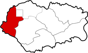
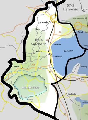
La Salendrie est un des 7 districts et le plus occidental de la Génésie. Son numéro administratif est 07-4, et sa capitale Great Lake City. La Salendrie est adjacente aux districts de Hanovrie et de Carolie, et aux Etats des Snowy Mountains, du Maxisland et de Simland Méridionale. La plus grande ville de Salendrie est Great Lake City avec 400 000 habitants.
Les volcans
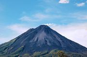
La Salendrie est renommé pour abrité le Parc Naturel Régional des Volcans et des paysages magnifiques sculptés par le feu. Les volcans se situent majoritairement au sud ouest du district, à la frontière avec l'état du Simland Méridional.
| Districts de Génésie | |
|---|---|
| Génésie Centrale (01) • Hanovrie (02) • Méridionie (03) • Salendrie (04) • Génésie Supérieure (05) • Carolie (06) • Basse Génésie (07) • Oakland District (08) |


