District of Columbia : Différence entre versions
Un article de WikiSimland 3.0.
| Ligne 16: | Ligne 16: | ||
! colspan="2" align="center" valign="middle" height="20" style="font-weight: bold; font-size: 1em; background: #1fA055; color: #ffffff" | <font size="2">'''Administration''' | ! colspan="2" align="center" valign="middle" height="20" style="font-weight: bold; font-size: 1em; background: #1fA055; color: #ffffff" | <font size="2">'''Administration''' | ||
|- | |- | ||
| − | | <font color=#3265fd>'''Chef-lieu'''</font color> || align="center" | [[Sonoma DC]] | + | | <font color=#3265fd>'''Chef-lieu'''</font color> || align="center" | [[Sonoma DC]] |
| + | |- | ||
| + | | <font color=#3265fd>'''Compté'''</font color> || align="center" | [[Sonoma County]] - [[Oakdale County]] - [[Fairview County]] - [[Hill Valley County]] | ||
|- | |- | ||
! colspan="2" align="center" valign="middle" height="20" style="font-weight: bold; font-size: 1em; background: #1fA055; color: #ffffff" | <font size="2">'''Données statistiques et géographiques''' | ! colspan="2" align="center" valign="middle" height="20" style="font-weight: bold; font-size: 1em; background: #1fA055; color: #ffffff" | <font size="2">'''Données statistiques et géographiques''' | ||
|- | |- | ||
| − | |<font color=#3265fd>'''Superficie'''</font color> || align="center" | | + | |<font color=#3265fd>'''Superficie'''</font color> || align="center" | 3328 km2 |
|- | |- | ||
| − | |<font color=#3265fd>'''Gentilé'''</font color>|| align="center" | | + | |<font color=#3265fd>'''Gentilé'''</font color>|| align="center" | Columbien |
|- | |- | ||
|<font color=#3265fd>'''Population'''</font color> || align="center" | 12 900 000 env. hab. | |<font color=#3265fd>'''Population'''</font color> || align="center" | 12 900 000 env. hab. | ||
|- | |- | ||
| − | |<font color=#3265fd>'''Densité'''</font color> || align="center" | | + | |<font color=#3265fd>'''Densité'''</font color> || align="center" | 3876 hab/km2 |
| − | + | ||
| − | + | ||
| − | + | ||
| − | + | ||
|- | |- | ||
| − | + | |<font color=#3265fd>'''Villes importantes'''</font color> || align="center" | [[Sonoma DC]] - [[Fairview]] - [[Oakdale]] - [[Hill Valley]] | |
|- | |- | ||
! colspan="2" align="center" valign="middle" height="20" style="font-weight: bold; font-size: 1em; background: #1fA055; color: #ffffff" | <font size="2">'''Carte'''</font size> | ! colspan="2" align="center" valign="middle" height="20" style="font-weight: bold; font-size: 1em; background: #1fA055; color: #ffffff" | <font size="2">'''Carte'''</font size> | ||
|- | |- | ||
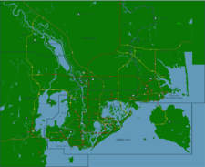
| − | ! colspan="2" align="center" | | + | ! colspan="2" align="center" | [[Image:Sonomametromapsmall.png|225px]] |
|} | |} | ||
| − | |||
| − | |||
{{Lien districts génésie}} | {{Lien districts génésie}} | ||
Version du 29 novembre 2012 à 00:24
| District of Columbia | |
|---|---|
| Pays | Simland |
| Région/Etat | Génésie (GE) | 08 |
| Langue majoritaire | Anglais |
| Autres langues courantes | Français, Espagnol, Simlish. |
| Administration | |
| Chef-lieu | Sonoma DC |
| Compté | Sonoma County - Oakdale County - Fairview County - Hill Valley County |
| Données statistiques et géographiques | |
| Superficie | 3328 km2 |
| Gentilé | Columbien |
| Population | 12 900 000 env. hab. |
| Densité | 3876 hab/km2 |
| Villes importantes | Sonoma DC - Fairview - Oakdale - Hill Valley |
| Carte | |

| |
| Districts de Génésie | |
|---|---|
| Génésie Centrale (01) • Hanovrie (02) • Méridionie (03) • Salendrie (04) • Génésie Supérieure (05) • Carolie (06) • Basse Génésie (07) • Oakland District (08) |