Rivendale : Différence entre versions
Un article de WikiSimland 3.0.
(TABLEAU FINAL) |
|||
| Ligne 7: | Ligne 7: | ||
|+ '''[[Villes de Simland]]''' | |+ '''[[Villes de Simland]]''' | ||
|- | |- | ||
| − | | colspan="2" bgcolor="white" align="center" | [[Image:RIVpatch.jpg|275px]] | + | | colspan="2" bgcolor="white" align="center" | [[Image:RIVpatch.jpg|275px]]<br/><br/><br/> Surnom : ''The Rainy Emerald''<br/> L'Émeraude Pluivieuse |
|- | |- | ||
| '''Pays''' | | '''Pays''' | ||
| Ligne 40: | Ligne 40: | ||
| bgcolor=#EEEEEE | 341 m Hudson River<br/>721 m Prosper Hill<br/> 1246 m Berryview Station | | bgcolor=#EEEEEE | 341 m Hudson River<br/>721 m Prosper Hill<br/> 1246 m Berryview Station | ||
|- | |- | ||
| − | | '''Point Culminant''' | + | | '''Point <br/>Culminant''' |
| − | | bgcolor=#EEEEEE | Mont Bradley à 3409 m | + | | bgcolor=#EEEEEE | Mont Bradley à 3409 m<br/><br/> |
|- | |- | ||
| colspan="2" bgcolor="white" | <font color=#6ca8dc> '''Population''' | | colspan="2" bgcolor="white" | <font color=#6ca8dc> '''Population''' | ||
| Ligne 56: | Ligne 56: | ||
| colspan="2" bgcolor="white" | <font color=#6ca8dc> '''Informations''' | | colspan="2" bgcolor="white" | <font color=#6ca8dc> '''Informations''' | ||
|- | |- | ||
| − | | '''Fuseau Horaire''' | + | | '''Fuseau <br/>Horaire''' |
| − | | bgcolor=#EEEEEE | <br/> | + | | bgcolor=#EEEEEE | UTC -11<br/><br/> |
|- | |- | ||
| '''Code Postal<br/><br/>''' | | '''Code Postal<br/><br/>''' | ||
| − | | bgcolor=#EEEEEE | 10-720, 10-721, 10-722, 10-723, 10- | + | | bgcolor=#EEEEEE | 10-720, 10-721, 10-722, 10-723, 10-752, 10-753, 10-754 |
|- | |- | ||
| '''Site Officiel''' | | '''Site Officiel''' | ||
Version du 29 mars 2012 à 21:23
|
||
|---|---|---|
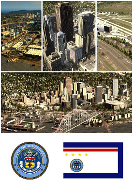
 Surnom : The Rainy Emerald L'Émeraude Pluivieuse | ||
| Pays | Simland | |
| État | Queens | |
| Districts |
Rivendale Lawnwood Evergreen Shelby Austin Peak Mont Kinley | |
| Organisation | ||
| Type | Semi-indirecte | |
| Législatif | City Council of Rivendale | |
| Exécutif | Rivendale Mayor Office | |
| Maire | Matthew Allen McKnight | |
| Géographie | ||
| Superficie |
Totale : 238,4 km2 Terre : 221,8 km2 (93%) Eau : 16,7 km2 (7%) | |
| Altitude |
341 m Hudson River 721 m Prosper Hill 1246 m Berryview Station | |
| Point Culminant |
Mont Bradley à 3409 m | |
| Population | ||
| Centre Urbain | 472'584 habitants | |
| Agglomération | 631'934 habitants | |
| Densité | 2'650,73 habitants/km2 | |
| Informations | ||
| Fuseau Horaire |
UTC -11 | |
| Code Postal |
10-720, 10-721, 10-722, 10-723, 10-752, 10-753, 10-754 | |
| Site Officiel | City Of Rivendale.eu | |

| ||