Sankt-Loritz : Différence entre versions
Un article de WikiSimland 3.0.
| Ligne 59: | Ligne 59: | ||
page en construction | page en construction | ||
| + | |||
| + | <br clear="all"> | ||
| + | <center> | ||
| + | {| class="toccolours" style="margin: 0 2em 0 2em;" | ||
| + | ! style="background:#095228" align="center" width="100%" | Villes de l' [[Obersimland - Whamfalen]] | ||
| + | | [[Fichier:Flagsnowymountains3wmp.jpg|50px|Drapeau de Simland]] | ||
| + | |- | ||
| + | | align="center" style="font-size: 90%;" colspan="2" | [[Aarenburg]] | [[Hydrienstein]] | [[Sankt-Loritz]] | [[Talstadt]] | [[Thurgau]] | [[Trabzon]] | [[Vanhoven]] | ||
| + | |} | ||
Version du 7 novembre 2013 à 15:40
| Sankt-Loritz Le coeur du Meara | |
|---|---|

| |
| Administration | |
| Pays | Simland |
| État | Obersimland - Whamfalen |
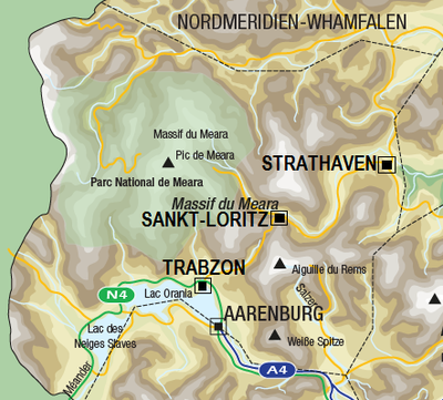
| District | Massif du Meara |
| Code postal | 10600 |
| Langue(s) reconnues(s) | Allemand - Français |
| Maire | Ingrid Missfelder (BNP) Roxboro |
| Intercommunalité | Nc |
| Villes jumelées | Collioure, FRA Lausanne, CHE |
| Site web | Topic de la ville |
| Démographie | |
| Population | 12.092 hab. |
| Aire urbaine | Nc hab. |
| Densité | 269.4 hab. au km² |
| Gentillé | loritzien, loritzienne |
| Economie | |
| Budget 2012 | 7.220.000 |
| PIB | 43.220 net/hab. |
| Taux de chômage | 3,9% |
| Université | Nc |
| Aéroport | Nc |
| Géographie | |
| Altitude | entre 907 et 1056 mètres |
| Superficie | 44.88 km² |
| Localisation | |

| |
page en construction
| Villes de l' Obersimland - Whamfalen | |
|---|---|
| Aarenburg | Hydrienstein | Sankt-Loritz | Talstadt | Thurgau | Trabzon | Vanhoven | |