Modèle:Infobox Canton de Kendle : Différence entre versions
Un article de WikiSimland 3.0.
| Ligne 33: | Ligne 33: | ||
! colspan="2" align="center" valign="middle" height="20" style="font-weight: bold; font-size: 1em; background: #e0dbba; color: #000000" | <font size="2">'''Démographie''' | ! colspan="2" align="center" valign="middle" height="20" style="font-weight: bold; font-size: 1em; background: #e0dbba; color: #000000" | <font size="2">'''Démographie''' | ||
|- | |- | ||
| − | | <font color=#000000>'''Population'''</font color> || align="left" | | + | | <font color=#000000>'''Population'''</font color> || align="left" | 456.678 hab. |
|- | |- | ||
| <font color=#000000>'''Densité'''</font color> || align="left" | 70.9 hab./km² | | <font color=#000000>'''Densité'''</font color> || align="left" | 70.9 hab./km² | ||
Version actuelle en date du 24 novembre 2013 à 23:51
| Canton de Kendle | |
|---|---|
| Canton of Kendle (en) | |
 
| |
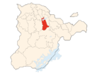
| Drapeau Localisation | |
| Administration | |
| Etat | |
| Abréviation | KE |
| Langue officielle | Anglais |
| Capitale | Kendle |
| Districts | ?? |
| Communes | 24 |
| Exécutif | Président du Canton (Georges Moustakiche PTS) |
| Législatif | Conseil Cantonnal (depuis 1872) |
| Conseil national | 7 sièges |
| Conseil des cantons | 2 sièges |
| Démographie | |
| Population | 456.678 hab. |
| Densité | 70.9 hab./km² |
| Gentilé | Kendolais, Kendolaise |
| Rang | ?? |
| Géographie | |
| Superficie | 4 231 km² |
| Rang | ?? |