Las Islas De La Reina
Un article de WikiSimland 3.0.
| LAS ISLAS DE LA REINA | |
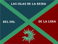
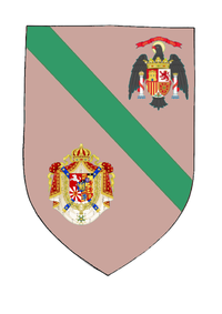
  Drapeau & Héraldique de Las Islas De La Reina | |
| Localisation | |
| Pays | Fédération de Simland |
| État | Papaya |
| District | English Harbor |
| Administration | |
| Maire | Ana Ninez (Yassou) |
| Code Postal | bientot |
| Indicatif téléphonique | en cours |
| Démographie | |
| Population (2013) | 5 903 228 hab |
| Agglomération | 10 175 348 hab |
| Densité | 5.110 hab. au km² |
| Langues officielles | Français, Espagnol, Anglais |
| Économie | |
| Budget | 1,6 Mrd § |
| PIB | $282.89B |
| PIB/Habitants | $73 215 |
| Taux de Chômage | 2,7% |
| Aéroport | Aéroport International de Constancy Charles 3 |
| Port | Las Islas-Puerto Del ¨Pasifico |
| Géographie | |
| Superficie | 2459 km² |
| Altitude | de -2 m à +32 m |
| fuseau horaire | UTC-10 |
| Divers | |
| Fondation | 1897 |
| Devise | Amis et Unis / Friends and Uniteds / Amigos y Unidos |
| Jumelage | |
| Classement universitaire | Beta |
| <span; style="font-weight: ; font-size: 1.1em; color: #ffffff ">Principauté d'English Harbor</span> | | |
|---|---|---|
| Cet article traite de la ville de Las Islas De La Reina, Métropole de l'English Harbor; pour plus de détails consultez l'article wikisimland de l'English Harbor 
|