Canton d'Oranie : Différence entre versions
Un article de WikiSimland 3.0.
| Ligne 1: | Ligne 1: | ||
{| class="toccolours" style="float:right;margin: 0em 0em 0em 1em;" | {| class="toccolours" style="float:right;margin: 0em 0em 0em 1em;" | ||
|- | |- | ||
| − | ! colspan="2" align="center" valign="middle" height="40" style="font-weight: bold; font-size: 1em; background: # | + | ! colspan="2" align="center" valign="middle" height="40" style="font-weight: bold; font-size: 1em; background: #D90115; color: #FFFFFF" | <font size="4">'''Canton d'Oranie''' <br> |
|- | |- | ||
| − | |<font | + | !colspan="2" align="center" | <font size='''''2'''''>Kreis dei Orania (de) <br> Cerchio di Orania (it)</font size> |
|- | |- | ||
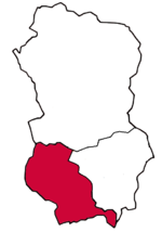
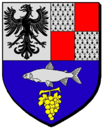
| − | | | + | | colspan="2" align="center" |[[Fichier:Nouvodrapeauprovinceoranieavecblason.png|150px|right|'''drapeau''']] <br> [[Fichier:Blasonoranie.png|150px|right]] [[Fichier:Oranieenwhamphalie.png|150px]] |
|- | |- | ||
| − | |<font | + | ! colspan="2" align="center" valign="middle" height="20" style="font-weight: bold; font-size: 1em; background: #D90115; color: #FFFFFF" | <font size="2">'''Administration''' |
|- | |- | ||
| − | |<font color=# | + | | <font color=#000000>'''Etat'''</font color> || align="center" | [[Whamphalie]] [[Fichier:DrapeauWH.png|20px|'''drapeau''']] |
|- | |- | ||
| − | |<font color=# | + | | <font color=#000000>'''Forme administrative'''</font color> || align="center" | '''Canton Fédéral''' |
|- | |- | ||
| − | ! colspan="2" align="center" valign="middle" height="20" style="font-weight: bold; font-size: 1em; background: # | + | | <font color=#000000>'''Chef-lieu'''</font color> || align="center" | '''[[Logano]]''' |
| + | |- | ||
| + | | <font color=#000000>'''Préfet'''</font color> || align="center" | '''Nc''' | ||
| + | |- | ||
| + | | <font color=#000000>'''Subdivisions'''</font color> || align="center" | '''Abrozze''', '''Adiggio''' <br> '''Gressone''', '''Tessino''' | ||
| + | |- | ||
| + | | <font color=#000000>'''Municipalités'''</font color> || align="center" | [[Coire]], [[Logano]] <br> [[Neuchâtel]], [[Traeste]] <br> | ||
| + | |- | ||
| + | | <font color=#000000>'''Communes RP'''</font color> || align="center" | '''80''' | ||
| + | |- | ||
| + | | <font color=#000000>'''Langue(s) officielle(s)'''</font color> || align="center" | '''allemand<br/>italien<br/>''' | ||
| + | |- | ||
| + | |<font color=#000000>'''Gentilé'''</font color>|| align="center" | '''oranais,<br /> oranaise''' | ||
| + | |- | ||
| + | |<font color=#000000>'''Code postal'''</font color>|| align="center" | '''10100''' | ||
| + | |- | ||
| + | ! colspan="2" align="center" valign="middle" height="20" style="font-weight: bold; font-size: 1em; background: #D90115; color: #FFFFFF" | <font size="2">'''Géographie''' | ||
| + | |- | ||
| + | |<font color=#000000>'''Superficie'''</font color> || align="center" | '''35.112 km²''' | ||
| + | |- | ||
| + | |<font color=#000000>'''Point culminant'''</font color> || align="center" | '''Mont Orania - 3778 mètres''' | ||
| + | |- | ||
| + | ! colspan="2" align="center" valign="middle" height="20" style="font-weight: bold; font-size: 1em; background: #D90115; color: #FFFFFF" | <font size="2">'''Démographie''' | ||
| + | |- | ||
| + | |<font color=#000000>'''Population'''</font color> || align="center" |'''536.145''' | ||
| + | |- | ||
| + | |<font color=#000000>'''Densité'''</font color> || align="center" | '''15,3 hab/km2''' | ||
| + | |- | ||
| + | |<font color=#000000>'''Villes principales'''</font color> || align="center" | [[Logano]], [[Traeste]]<br>'''''Santa-Barbara''''', '''''Chur'''''<br>'''''Trente''''', '''''Porto''''' | ||
| + | |- | ||
| + | ! colspan="2" align="center" valign="middle" height="20" style="font-weight: bold; font-size: 1em; background: #D90115; color: #FFFFFF" | <font size="2">'''Economie''' | ||
| + | |- | ||
| + | |<font color=#000000>'''PIB nominal'''</font color> || align="center" |'''105,2 milliards §''' | ||
| + | |- | ||
| + | |<font color=#000000>'''IDH'''</font color> || align="center" |'''0,808 (très élevé)''' | ||
| + | |- | ||
| + | |<font color=#000000>'''Monnaie'''</font color> || align="center" |'''Simléon whamphalien (WH§)''' | ||
| + | |- | ||
| + | ! colspan="2" align="center" valign="middle" height="20" style="font-weight: bold; font-size: 1em; background: #D90115; color: #FFFFFF" | <font size="2">'''Politique'''</font size> | ||
| + | |- | ||
| + | | <font color=#000000>'''Députés parlementaires'''</font color> || align="center" | '''20 sièges''' | ||
| + | |- | ||
| + | | colspan="2" style="text-align: center; padding-top: 0.7em; padding-bottom: 0.7em;" | | ||
| + | [[250px]] | ||
| + | |- | ||
| + | | <font color=#000000>'''Députés fédéraux'''</font color> || align="center" | '''Nc''' | ||
| + | |- | ||
| + | ! colspan="2" align="center" valign="middle" height="20" style="font-weight: bold; font-size: 1em; background: #D90115; color: #FFFFFF" | <font size="2">'''Autres informations'''</font size> | ||
| + | |- | ||
| + | | <font color=#000000>'''Code Etat'''</font color> || align="center" | '''WH | 10''' | ||
| + | |- | ||
| + | | <font color=#000000>'''Fuseau horaire'''</font color> || align="center" | '''-11''' | ||
| + | |- | ||
| + | | <font color=#000000>'''Domaine internet'''</font color> || align="center" | '''.wh.sim''' | ||
| + | |- | ||
| + | | <font color=#000000>'''Site web'''</font color> || align="center" | [http://www.simland.eu/forum/territoires/canton-oranie-t18485.html/ Forum du canton] | ||
|- | |- | ||
| − | |||
|} | |} | ||
| + | [[Fichier:Carteofficielleoranie.png|350px|thumb|right|'''Carte officielle''' ''au 01 octobre 2016'']] | ||
| + | |||
| + | |||
| + | |||
| + | |||
| + | en cours de rédaction | ||
| + | |||
| + | |||
| + | |||
| + | |||
| + | |||
| + | |||
| + | |||
| + | |||
| + | |||
| + | |||
| + | |||
| + | |||
| + | |||
| + | |||
| + | |||
| + | |||
| + | |||
| + | |||
| + | |||
| + | |||
| + | |||
| + | |||
| + | |||
| + | |||
| + | |||
| + | |||
| + | |||
| + | |||
| + | |||
| + | |||
| + | |||
| + | |||
| + | |||
| + | |||
| + | |||
| + | |||
| + | |||
| + | |||
| + | |||
| + | |||
| + | |||
| + | |||
| + | |||
| + | |||
| + | |||
| + | |||
| + | |||
| + | |||
| + | |||
| + | |||
| + | |||
| + | |||
| + | |||
| + | |||
| + | |||
| + | |||
| + | |||
| + | |||
| + | |||
| + | |||
| + | |||
| + | |||
| + | |||
| + | |||
| + | |||
| + | |||
| + | |||
| + | |||
| + | |||
| + | |||
| + | |||
| + | |||
| + | |||
| + | |||
| + | |||
| + | |||
| + | |||
| + | |||
| + | |||
| + | |||
| + | |||
| + | |||
| + | |||
| + | |||
| + | |||
| + | |||
| + | |||
| + | |||
| + | |||
| + | |||
| + | |||
| + | |||
| + | |||
| + | |||
| + | |||
| + | |||
| + | |||
| + | |||
| + | |||
| + | |||
| + | |||
| + | |||
| + | |||
| + | |||
| + | |||
| − | |||
Version du 22 octobre 2016 à 12:21
| Canton d'Oranie | |
|---|---|
| Kreis dei Orania (de) Cerchio di Orania (it) | |

| |
| Administration | |
| Etat | Whamphalie |
| Forme administrative | Canton Fédéral |
| Chef-lieu | Logano |
| Préfet | Nc |
| Subdivisions | Abrozze, Adiggio Gressone, Tessino |
| Municipalités | Coire, Logano Neuchâtel, Traeste |
| Communes RP | 80 |
| Langue(s) officielle(s) | allemand italien |
| Gentilé | oranais, oranaise |
| Code postal | 10100 |
| Géographie | |
| Superficie | 35.112 km² |
| Point culminant | Mont Orania - 3778 mètres |
| Démographie | |
| Population | 536.145 |
| Densité | 15,3 hab/km2 |
| Villes principales | Logano, Traeste Santa-Barbara, Chur Trente, Porto |
| Economie | |
| PIB nominal | 105,2 milliards § |
| IDH | 0,808 (très élevé) |
| Monnaie | Simléon whamphalien (WH§) |
| Politique | |
| Députés parlementaires | 20 sièges |
| Députés fédéraux | Nc |
| Autres informations | |
| Code Etat | WH | 10 |
| Fuseau horaire | -11 |
| Domaine internet | .wh.sim |
| Site web | Forum du canton |
en cours de rédaction
| Cantons de Whamphalie | |
|---|---|
| Canton d'Hochsberg | Canton d'Hanovrie | Canton d'Oranie |


