Malde : Différence entre versions
(→Administration locale) |
(→Autres) |
||
| Ligne 400: | Ligne 400: | ||
|- | |- | ||
| | | | ||
| − | !align="center" | <big>'''Quartiers de Malde'''</big> <br> [[Cité de Malde]] • [[Chelsington]] • [[ | + | !align="center" | <big>'''Quartiers de Malde'''</big> <br> [[Cité de Malde]] • [[Chelsington]] • [[Brookfield]] • [[Barrick]] • [[Hamptons]] • [[Chesterfield]] • [[Groomley]] • [[Greenwich]] |
---- | ---- | ||
|- | |- | ||
| Ligne 412: | Ligne 412: | ||
|- | |- | ||
| | | | ||
| − | !align="center" | <big>'''Sports'''</big> <br> [[Blue Birds]] • [[TD Garden]] • [[Malde | + | !align="center" | <big>'''Sports'''</big> <br> [[Blue Birds]] • [[TD Garden]] • [[Stade de Malde]] • [[John Smith Stadium]] • [[Malde Eagles]] |
|} | |} | ||
</center> | </center> | ||
Version du 29 avril 2015 à 14:28
| Ville de Simland Malde | |
|---|---|
 | |
| Administration | |
| Pays | Simland |
| État | Génésie (07) |
| District | Génésie Centrale |
| Comté | Comté de Malde |
| Quartiers | 24 Boroughs |
| Maire | Alexander Louis Davis (UDS) |
| Démographie | |
| Langues | Anglais (77%), Français (20%), Autres (3%) |
| Population | 951.103. (agglo) / 62.603 (ville)(2014) |
| Gentilé | Maldien, Maldienne |
| Moyenne d'âge population | 31,5 ans |
| Infrastructures et transport | |
| Aéroport principal | Aérodrome John Smith - (projet aéroport en cours) |
| Port principal | SeaPort Malde Génésia |
| LRS et LGV | LGV Est-Ouest - LRS Nord-Sud |
| Géographie | |
| Coordonées | 51°53'38.93"" Nord 176° 9'33.81"" Ouest |
| Superficie | 1 572 000 ha / 1 572km² |
| Altitude | Min. 0 m – Max. 21 m |
| Fuseau Horaire | UTC - 12 |
| Divers | |
| Fondation | Juin 1667 |
| Surnom | The New London / The City where all is possible |
| Localisation | |
| |
Malde est située au centre de la Génésie et capitale de Génésie Supérieure, est une ville de 62 000 habitants ; longtemps contrôlée par les Anglais. Fondée en 957 par les Yatupeks , Malde était au XIXe siècle la ville la plus peuplée de Génésie. Aujourd'hui largement dépassée dans ce domaine par de nombreuses villes, elle reste une métropole de tout premier plan, en raison de son rayonnement et de sa puissance économique considérable, due notamment à son statut de premier centre financier génésien et 4ème simlandais.
Le Grand Malde, composé de Inner Malde et Outer Malde, compte 951 103 habitants en 2014. Il réalise 21 % du produit intérieur brut de Génésie. L'aire urbaine de Malde compte 62 603 d'habitants, son agglomération 951 103 habitants, tandis que l'aire métropolitaine (sa zone urbaine élargie) ou zone d'influence directe, comptait 745 000 habitants en 2005. Les habitants de Malde sont appelés Maldois (en anglais: Maldeens)
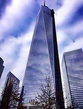
Malde est une ville dynamique et très diverse sur le plan culturel. Elle joue un rôle important dans l'art et dans la mode. C'est aussi une importante destination touristique. Elle reçoit 11 millions de touristes par an et compte quatre sites listés au patrimoine mondial ainsi que de nombreux monuments emblématiques : la Tour de Malde , Victory Square, la Tour Énergie, la Tour de l'Horloge, le Palais des Anglais mais également des institutions telles que le Malde Museum ou la Simland Modern Gallery.
Sommaire
[masquer]- 1 Histoire
- 1.1 Origine
- 1.2 Renouveau et Arrivée des anglais (1652-1723)
- 1.3 La Construction de Malde (1723-1834)
- 1.4 Arrivée de l'armée anglaise (1834-1896)
- 1.5 Tensions entre Citizens et Metropolitains(1896-1899)
- 1.6 Les deux guerres mondiales(1900-1945)
- 1.7 Après-guerre et indépendance (1945-1961)
- 1.8 Epoque Contemporaine (1961-....)
- 2 Administration et Quartiers
- 3 Démographie
- 4 Géographie et Climat
- 5 Transports
- 6 Économie
- 7 Média
- 8 Sécurité
- 9 Autres
Histoire
Origine
Les origines de la cité remonte à 957 ap JC, où la ville est décrite comme un hameau accueillant des voyageurs égarée. Ce petit village est située dans les hauteurs de la ville. Mais la ville finira par être abandonnée à partir de l'an 1023. Les origines du nom de la ville restent inconnus.
Renouveau et Arrivée des anglais (1652-1723)
Mais en 1652, les hollandais découvre la ville séparée par le fleuve St Georges. Il décide d'y établir un port commercial celui est d'ailleurs toujours en activité aujourd'hui. Mais la tribu des Yatupeks refusent que les hollandais prennent une partie de leur territoire ce qui mènera à plusieurs guerres avant le départ des hollandais en 1688. C'est ensuite les français qui prennent le contrôle de la Génésie, mais il délaissent Malde ne trouvant pas la ville assez intéressante pour s'y installer. La ville reste donc un petit village de 260 habitants jusqu'en 1723 où des marchands anglais arrivent et on pour but de développer Malde.
La Construction de Malde (1723-1834)
Dès leur arrivée, ils souhaitent augmenter considérablement la population. Alors dès 1726, il lance la construction d'environ 200 maisons et également d'un endroit où il pourront diriger la ville. Les constructions seront terminés en 1729 pour les maisons et en 1733 pour le palais anglais. La population atteint 12000 habitants en 1735 et possède le taux de natalité le plus élevé de Génésie. Mais la crainte des anglais est que les français récupèrent la ville, donc en 1735, ils construisent une muraille autour de la ville. En 1741, les français attaquent la ville mais malgré leurs plusieurs tentatives, ils n'entreront jamais dans la ville. La ville restera calme jusqu'en 1834.
Arrivée de l'armée anglaise (1834-1896)
L'armée anglaise arrivent à Malde et décident d'y rester pour étendre la ville. Leur première action est de construire le Royal Bridge pour relier les deux parties de la ville. En 1835, la ville est composée de 7 quartiers. La ville est dirigée par John Smith qui fut désignée par le royaume d'Angleterre. Il fut le premier à penser à la construction d'une bourse dans la ville afin que les marchands puissent mieux contrôler leurs prix. La construction du Malde Garden Market est votée par le Parlement de Malde en 1842 avant d'être achevée en 1845. Ce lieu deviendra d'ailleurs une des place forte de Malde et il est situé dans la Royal Town. La ville continue son extension jusqu'en 1876 où la population est de 110 000 habitants et composée de 11 quartiers. Mais la crue de 1877 fait environ 68 000 morts et détruisit totalement la Cité de Malde et la Royal Town. Mais les survivants décidèrent de reconstruire ces quartiers comme ils étaient avant la crue. La reconstruction ne débutera qu'en 1880 et ne sera finit qu'en 1901. Au début des années 1890, un climat de tensions commencé exister entre les Citizens qui vivent dans Cité de Malde, le Royal Town et le vieux Malde et les Métropolitains qui vivent dans le reste de la ville. Ces tensions deviendront de plus en plus importante jusqu'en 1896.
Tensions entre Citizens et Metropolitains(1896-1899)
Les tensions entre les Citizens et les Métropolitains sont principalement dû au fait que les Métropolitains souhaités que les Citizens s'unifient avec eux pour former le Grand Malde. Les Citizens principalement fortunés refusés de vivre avec les Métropolitains majoritairement ouvriers et salariés. En octobre 1896, des grèves ont notamment lieu dans plusieurs usines au sud de la ville. Puis en février 1897, des manifestations ont lieu dans plusieurs endroit de la ville. Des affrontements commences à l'été 1897 et deviendront de plus en plus violents jusqu'en Mars 1898 où un affrontement dégénère en fusillade dans la South End. En Avril 1898, l'ancienne Tour de l'Horloge est détruite après l'explosion à l'intérieur de poudres à canon. Les Métropolitains sont accusés de cette destruction mais une enquête révélera que ceci n'était qu'une machination des Citizens. Une commission est alors chargé de rétablir la paix entre les diverses parties. C'est John Smith, célèbre maire de la ville est âge de 84 ans qui est chargé de cette commission. Pour une grande partie de la population, le calme est revenu mais des Citizens radicaux continue de mener la résistance et accuse la commission de renier leurs valeurs. Le 25 septembre 1899, John Smith est assassiné devant la gare de Baker Street, le meurtrier est Oliver Dawson, étudiant de 24 ans affilié aux Citizens. Désormais, toutes personnes proches des Citizens ou Citizens sera arrêté et emprisonné. Cette décision sera controversé mais permettra le retour de la paix en 1899.
Les deux guerres mondiales(1900-1945)
Le début de la guerre en 1914 eu des conséquences sur la vie des simlandais. Les hommes furent envoyés pour venir en aide aux britanniques alors que les femmes construisait des tanks, des armes et autres matériels nécessaires pour la guerre. Mais avec l'entrée en guerre des américains, les Maldois retournèrent à Malde et les femmes quittèrent les usines. La victoire en 1918 augmenta la population de la ville puisque de nombreux britanniques craignait une nouvelle guerre et décidèrent de venir à Malde. Entre les deux guerres, la ville se modernisa avec l'arrivée de l'électricité et l'ouverture de la première ligne de métro mais la seconde guerre mondiale changea la donne. L'avancée des japonais vers Malde inquiétait les anglais et la population qui se préparèrent à la guerre. Le 13 juin 1940, les japonais sont aux portes de Malde. Les anglais ouvrirent les portes de la ville à la grande surprise des japonais qui à l'intérieur furent enfermés dans la ville. Le peuple ayant des armes, les japonais furent massacrés et les survivants désespérés se jetèrent dans le fleuve St Georges. Cette résistance traumatisa les japonais qui ne revinrent jamais à Malde. À la fin de la guerre, la ville recommença son développement.
Après-guerre et indépendance (1945-1961)
Après la guerre, les anglais décidèrent de reconstruire la Tour de l'Horloge détruite en 1898. Très vite, ce bâtiment devenu un symbole de la ville. En 1948, on construit un nouveau marché couvert plus grand pour accueillir les marchands. Les années 50 furent pleines de construction imposantes comme le Royal Bridge. D'ailleurs en 1954, la ville connut la plus grande vague de froid de son histoire avec des températures moyennes de -32° d'ailleurs le fleuve St Georges fut gelés pendant 3 mois. En 1956, la Génésie devenu indépendante mais Malde souhaita restait sous le contrôle Anglais. Le nouveau maire de la ville élu en 1960 souhaitait se détacher des anglais tout comme une majeure partie de la population cela deviendra officiel en 1961 quand après un référendum fit que Malde rejoigna la Génésie Indépendante. Mais toutefois la ville conserve encore aujourd'hui des accords et des attaches fortes avec les britanniques.
Epoque Contemporaine (1961-....)
Après l'indépendance face aux Anglais, la ville s'est étendue très rapidement. La gare de Saint-Georges jugée trop vétuste et petite fut rénovée mais une nouvelle gare fut construite, c'est celle de Baker Street construite en 1968 et rénovée en 2008. Les premiers Building de la ville furent également construit comme la John Smith Tower construite en 1973. La ville se diversifia au niveau ethnique avec d'importantes vagues d'immigration dans les années 70 et 80. Le réseau de métro connu également une importante expansion depuis 1961. En 1989, Malde accueillit une conférence de paix. Les années 90 furent témoins de l'arrivée des ordinateurs dans les foyers maldois. Depuis 2000, la ville s'est tourné vers l'écologisme avec la construction d'éco-quartiers et la création d'un 25 eme quartier en 2014.
Administration et Quartiers
Administration locale
|
|
|
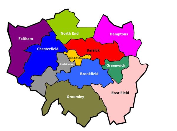
La ville est divisée en 11 quartiers chacun dirigée par un représentant de la mairie. Les quartiers les plus aisées sont Cité de Malde et Chelsington alors que les quartiers moins favorisés se trouvent principalement à la périphérie de la ville.
Jumelages
La villes est jumelée avec Constancy, Liverpool (UK), Lille (FRA), Lisbonne (POR) et Tanger (MAR)
Démographie
Évolution de la Population
| Année | Habitants |
|---|---|
| 1700 | 43 541 |
| 1750 | 54 981 |
| 1800 | 79 765 |
| 1810 | 84 236 |
| 1820 | 86 243 |
| 1830 | 88 657 |
| 1840 | 91 324 |
| 1850 | 92 347 |
| 1860 | 97 645 |
| 1870 | 110 345 |
| 1880 | 36 734 |
| 1890 | 28 134 |
| 1900 | 31 982 |
| Année | Habitants |
|---|---|
| 1910 | 36 432 |
| 1920 | 35 486 |
| 1930 | 38 198 |
| 1940 | 40 873 |
| 1950 | 39 234 |
| 1960 | 43 657 |
| 1970 | 47 895 |
| 1980 | 45 543 |
| 1990 | 49 670 |
| 2000 | 57 342 |
| 2014 | 62 603 |
Diversité ethnique
| Pays de naissance | Population en 2014 |
|---|---|
| Royaume-Uni |
13 000 |
| Simland |
38 000 |
| France |
8 500 |
| États-Unis |
1 590 |
| Italie 20px | 1 300 |
| Turquie 20px | 1 200 |
| Allemagne |
913 |
La force de la ville est sa grande diversité ethnique, composée en majorité d'habitants natifs du Royaume-Uni descendants des colons anglais. Il y a également des habitants originaires de Turquie, Italie, Allemagne, États-Unis, France et bien sûr de Simland. La religion majoritaire est le christianisme suivit de près par l'islam. La ville est composée en majorités de "blancs" mais la politique sociale et d'intégration à fait augmenter les population "noirs" et "métisses" de 82% depuis l'an 2000.
Résidents nées à l'étranger
Les chiffres de l'Office for National Statistics montrent que le nombre de Maldois nés à l'étranger atteignait 1 488 000 en 2010 contre 630 000 en 1997. Le tableau ci-contre donne le pays de naissance des résidents de Malde en 2014, date du dernier recensement simlandais.
Géographie et Climat
Géographie
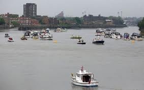
Le fleuve, qui traverse la ville d'ouest en est, a eu une influence majeure sur le développement de la ville. Malde a été fondée à l'origine sur la rive nord du fleuve St.Georges et n'a disposé, pendant plusieurs siècles, que d'un seul pont, le Pont Royal (Royal Bridge). Le foyer principal de la ville s'est en conséquence cantonné sur cette rive du St.Georges, jusqu'à la construction, au XXVIIIe siècle, d'une série d'autres ponts. La ville s'est alors étendue dans toutes les directions, cette expansion n'étant gênée par aucun obstacle naturel, dans une campagne presque dépourvue de reliefs, à l'exception de quelques collines (Parlihouse Hill, Priment Hill).
Le fleuve St.Georges était autrefois plus large et moins profond qu'aujourd'hui. Les rives du fleuve ont été massivement aménagées, la plupart des affluents ont été détournés et sont à présent souterrains, parfois transformés en égouts. Le St.Georges est sujette à la marée et Malde est largement inondable. Les menaces d'inondation augmentent d'ailleurs avec le temps compte tenu de l'élévation régulière du niveau de l'eau à marée haute et du long enfoncement de Malde (causée par un phénomène de relèvement isostatique). Un barrage, le Georges Water Gate, a été construit à travers le St.Georges à John Smith District dans les années 1970, pour pallier cette menace. En 2005 cependant, il a été suggéré la construction d'un barrage d'une quinzaine de kilomètres de long plus bas en aval pour parer les risques futurs d'inondation.
Climat
| Mois | Janv | Fév | Mars | Avr | Mai | Juin | Juil | Août | Sept | Oct | Nov | Déc | Année |
|---|---|---|---|---|---|---|---|---|---|---|---|---|---|
| Températures minimales moyennes (°C) | -1 | -2 | 4 | 6 | 7 | 8 | 10 | 11 | 15 | 13 | 9 | 4 | 7 |
| Températures moyennes (°C) | 0 | 4 | 8 | 10 | 13 | 16 | 19 | 25 | 18 | 14 | 11 | 7 | 12 |
| Températures maximales moyennes (°C) | 5 | 8 | 15 | 17 | 21 | 25 | 28 | 32 | 29 | 23 | 15 | 13 | 19,25 |
| Précipitations mensuelles moyennes (mm) | 81 | 69 | 55 | 43 | 31 | 19 | 5 | 52 | 11 | 22 | 42 | 79 | 509 |
Le climat de Malde est continental, relativement doux avec une assez faible pluviométrie. L'été est assez calme avec un mois de juillet plutôt doux aux niveaux des température et faible en pluviométrie alors que le mois d'Août est un mois pluvieux et chaud.
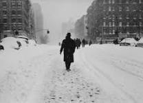
Les chutes de neige abondantes sont presque inconnues. Au cours des hivers les plus récents, la neige a rarement excédé un pouce d'épaisseur (soit moins de 3 cm). Ceci est notamment dû au fait que la vaste agglomération maldoise crée un microclimat, avec une chaleur enfermée par les immeubles de la ville. La nuit, la température y est parfois de 5 à 9 ℃ supérieure aux zones environnantes.
Risques Climatiques et géographiques
Risques de Crue
En raison de son altitude assez faible et la montée des eaux, Malde est fortement exposée au risques de crue. La plus importante eu lieu en 1877 et fit 68 000 morts et pulvérisa les quartiers du Vieux Malde, la Royal Town et la Cité de Malde. Le niveau du St.Georges monta jusqu'à 10 mètres au dessus de son niveau habituel. Aujourd'hui, des aménagements ont étés construit pour éviter une telle catastrophe de se reproduire. Les risques demeurent malheureusement élevée avec une montée des eaux estimés à 8 mètres qui détruirait le réseau de métro de la ville et submergerait environ 60 % de la ville
Phénomène de Schwartz
Le phénomène de Schwartz est un phénomène dût à la compression souterraine de la micro-plaques tectonique sur laquelle est située la ville. Ce qui fait que chaque année, la ville s'enfonce un peu plus dans le sol. Mais depuis le début des années 2000, le phénomène s'accentue avec un enfoncement de 1 cm par an contre 0,1 cm au XXeme siècle. Ce phénomène conjugué à la montée des eaux menacent à terme à la disparition totale de Malde sous les eaux. Le point culminant de la ville étant à 24 mètres, un submersion de la ville n'aurait lieu qu'en 2250 mais les premiers quartiers seraient inondés dès 2100.
Quartiers
On décrit souvent Malde par quartiers (Royal Town, Seaport, John Smith District par exemple). Ces noms n'ont pas d'utilisation officielle mais désignent souvent des paroisses (parishes) ou des circonscriptions (city wards) et sont restés en usage par tradition, chacun faisant référence à un quartier distinct avec ses propres caractéristiques mais sans délimitation officielle.Les quartiers les plus huppés sont l'Amsterdam Hills et le district de Little Way, où vivent d'ailleurs de nombreuses personnalités maldoises.
Urbanisation
La densité de population varie considérablement à Malde. Le centre regroupe de nombreux emplois tandis que la périphérie de la ville regroupe des zones résidentielles plus ou moins densément peuplées, la densité étant plus élevée dans la proche banlieue (Inner Malde) que dans les banlieues plus éloignées (Outer Malde). Les zones densément peuplées regroupent principalement des immeubles de grande hauteur et les gratte-ciels de Malde sont concentrés dans les deux quartiers d'affaires, tels que la Tour Énergie, le United Building et les Twins Tower dans le South End District, One Trade Plaza, John Smith Tower et la Two Trade Plaza à Building Place.
D'autres bâtiments remarquables de Malde incluent la Tour de Malde , Victory Square, la Tour Énergie, la Tour de l'Horloge, le Palais des Anglais dans la Cité de Malde et la Royal Town, le Malde Muséum et la Simland Modern Gallery respectivement à Little Way et la North End District . La centrale électrique de Baker District, toujours en activité , est un symbole marquant, tandis que certaines gares, notamment Saint-Georges, sont de bons exemples de l'architecture victorienne.
Transports
Les transports sont un des quatre domaines de compétence du maire de Malde bien que son contrôle financier soit assez limité et qu'il n'ait aucun pouvoir sur le réseau ferré (mais le Central Malde Railway est sous sa responsabilité depuis novembre 2003).Le réseau de transport public, géré par Transport for Malde (TfM), est un des plus étendus au monde mais subit tous les jours des embouteillages et retards. Un programme de 7 milliards de livres a été mis en place pour tenter d'améliorer le réseau à l'horizon de 2012. Malgré un coût des plus élevés de Simland, l'ensemble du réseau maldois a cependant été déclaré meilleur réseau de transport au monde (devant Londres et Paris) par 25 % des 2 000 personnes interrogées lors d'un sondage réalisé par TripAdvisor.
Transports ferroviaires
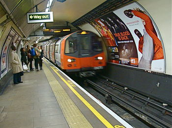
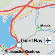
L'élément central du réseau de transport de Malde est son métro, Underground ou Malde Tube appelé familièrement The Tube, composé de 274 stations et 16 lignes interconnectées pour une longueur totale de 408 km. Il existe de nombreux projets d'extensions, notamment au sud de la ville, et même la construction d'une nouvelle ligne de Chelsington à Building place qui a comme nom initial Malde-Forest Parl. Inauguré en 1920, c'est le plus ancien réseau de Génésie. Il comporte même la toute première ligne de métro électrique, la City & North Malde Railway, mise en service en 1922. Trois millions de trajets par jour, soit environ un milliard par an, sont effectués sur l'ensemble du réseau du métro, qui dessert principalement le centre historique de Malde ainsi que les banlieues de la ville situées au nord du St.Georges mais s'étend jusqu'au-delà des frontières du Grand Malde. Du fait de la nature des sols, les banlieues sud et sud-est sont moins desservies par le métro mais bénéficient d'un important réseau de trains de banlieue. Le DockPort Light Railway, inauguré en 1987, dessert l'est de Malde et John Smith District sur les deux rives du St.Georges. Les trains de banlieue ne traversent généralement pas la ville mais s'arrêtent dans une des 14 gares de la ville situées autour du centre historique. Crossrail est un projet de réseau express régional qui devrait entrer en fonction en 2015 et qui permettra de relier les banlieues est et ouest en traversant Malde dans un souterrain, un train urbain, l'overground qui est entré en service en novembre 2007. Le service de train Généstar relie la gare de Baker Street à Oakdale et Giant Bay (Génésie) en 1 h 10 et 35 minutes respectivement, et Constancy sur Mer (Papaya) en 2 h 50. Il y a aussi des projets d'insertion du métro aérien dans Malde.
Économie
Par le PIB, Malde est en 2014 la sixième ville de Simland, et la deuxième de Génésie après Oakdale. Le Grand Malde réalise environ 20 % du PIB de Génésie, et l'aire métropolitaine de Malde environ un tiers. La productivité est nettement supérieure à la moyenne nationale. Très fortement tertiarisée, Malde connaît une importante spécialisation dans la finance. Malde est la seizième place financière du monde et l'un des principaux centres d'affaires internationaux. L'immigration joue un rôle majeur, elle concerne des personnes de qualification très diverses, mais une des caractéristiques de la ville est sa capacité à attirer les hauts revenus. Les inégalités économiques sont fortes. Malde compte de nombreuses poches de pauvreté et le taux de chômage est plus élevé que la moyenne nationale (5,5 % en Génésie au deuxième trimestre 2011 contre 8 % à Malde et jusqu'à plus de 15 % dans certains quartiers de l'Inner Malde) et 45 % des enfants de ces quartiers vivent dans un état de pauvreté.
Attractivité
L'économie de Malde s'est orientée vers les services beaucoup plus tôt que d'autres villes simlandaises, surtout après la Seconde Guerre mondiale. Le succès de Malde dans le secteur tertiaire s'explique surtout par plusieurs des facteurs: -l'anglais est une langue de communication internationale, -sa position centrale en Génésie, -ses relations particulières avec l'Europe et plusieurs pays d'Asie, -sa position géographique qui permet à ses horaires de bureau de correspondre à ceux d'autres pays qui comptent pour 99 % du PNB mondial, les infrastructures multiculturelles (écoles, lieux de culte, organisations culturelles et sociales), -un niveau d'impôt relativement peu élevé surtout pour les étrangers (les résidents non domiciliés à Simland ne payent pas de taxe sur les profits réalisés à l'étranger) - cependant, la taxe du comté (équivalent de la taxe d'habitation française) payée chaque mois est très élevée (environ 200-250 simléons/mois/logement). -de bonnes infrastructures de transport, surtout dans le trafic aéroportuaire -une économie dérégulée avec peu d'intervention du gouvernement.
Tourisme
Malde est une des principales destinations touristiques au monde. Ce secteur génère entre 280 000 et 350000 emplois selon les sources. En 2013, 24,7 millions de touristes ont visité Malde, ce qui représente des revenus de 12,1 milliards de simléons. De ces 24,7 millions de touristes, 7,8 millions étaient de Simland. Malde bénéficie de son statut de ville anglophone en Génésie et attire ainsi chaque année de très nombreux étudiants du monde entier venus faire leurs études. Une importante économie du tourisme s'est développée autour de cette manne, certains n'hésitant pas à en profiter par des pratiques à la limite de la légalité. Les principaux sites touristiques maldois sont concentrés dans le Central Square, qui comprend les grands magasins de Bengton Street, les théâtres, et les quartiers tels que Forest Park Zone, SeaPort, North End District et Victory Square. Les monuments les plus célèbres de Malde sont le Malde Museum, la Simland Modern Gallery, la Tour de l'Horloge, le Royal Bridge, La vieille bourse, le Palais des anglais et bien d'autres.
Média
Malde est un des premiers centres de communication de Simland avec la présence d'un grand nombre d'entreprises de communication. La plupart des grands média simlandais et tous les grands réseaux de télévisions nationaux, dont ITS , le plus important service d'information au monde, ont leur siège à Malde. Environ 43 % des emplois simlandais liés à la télévision et à la radio sont concentrés à Malde. Cette concentration a souvent amené certains commentateurs à critiquer le centrage de Simland sur Malde.
Il existe deux journaux locaux à Malde, l'Evening News et le Malde Times, tous les deux gratuits. Ils sont disponibles dans la rue ainsi que dans le métro et les gares. MeMagazine, un guide indépendant hebdomadaire fournit la liste des concerts, films, pièces de théâtre et autres activités culturelles depuis 1974. Il existe de nombreux autres journaux locaux dans l'agglomération maldoise, rapportant des informations très locales.
Sécurité
Police
Le Metropolitan Malde Police (généralement connu sous son ancien nom officiel de Metropolitan Force , ou plus familièrement en tant que The Metro) est la force territoriale de police responsable du Grand Malde à l'exception de la Royal Town, qui a sa propre force de police : la Royal Guards.
Autres

|
<span; style="font-weight: ; font-size: 1.5em; color:#ffffff"> Ville de Malde </span> | 
|
|---|---|---|
| Transports Métro de Malde • Aéroport de Malde • Transports en communs de Malde | ||
| Quartiers de Malde Cité de Malde • Chelsington • Brookfield • Barrick • Hamptons • Chesterfield • Groomley • Greenwich | ||
| Personnalités Alexander Louis Davis • John Smith | ||
| Lieux importants et monuments Victory Square • Tour de l'horloge • New Garden Market | ||
| Sports Blue Birds • TD Garden • Stade de Malde • John Smith Stadium • Malde Eagles |
| Villes de Génésie | |
|---|---|
| Oakdale • Armor • Bay City • Berneuil • Carlossane • Columbia 3000 • Giant Bay • Hustines • Malde • Minéapolis/Shadows • Naules • Paname • Patalia • Pyrtal • Saint Ignace • Saint-Servin • Sonoma • Windhoek |
