Medrean City Lawndale Airport : Différence entre versions
Un article de WikiSimland 3.0.
(Actualisation) |
|||
| Ligne 6: | Ligne 6: | ||
! colspan="2" align="center" valign="middle" height="40" style="font-weight: bold; font-size: 1em; background:#0e89b5; color: #ffffff" | <font size="4">[[Image:Icone-avion.jpg]]MEDREAN CITY-LAWNDALE</font size> | ! colspan="2" align="center" valign="middle" height="40" style="font-weight: bold; font-size: 1em; background:#0e89b5; color: #ffffff" | <font size="4">[[Image:Icone-avion.jpg]]MEDREAN CITY-LAWNDALE</font size> | ||
|- | |- | ||
| − | | colspan="2" align="center" | | + | | colspan="2" align="center" | [[Image:Logo Aeroport de Lawndale.png|290px]] |
|- | |- | ||
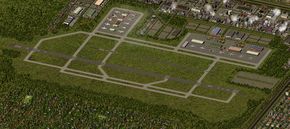
| − | | colspan="2" align="center" | | + | | colspan="2" align="center" | [[Image:Aeroport de MedreanCity Lawndale.jpg|290px]] |
|- | |- | ||
! colspan="2" align="center" valign="middle" height="20" ; font-size: 1em; background: #ffffff; color: #000000"| Code [[AITA]] <br> '''MCL''' | ! colspan="2" align="center" valign="middle" height="20" ; font-size: 1em; background: #ffffff; color: #000000"| Code [[AITA]] <br> '''MCL''' | ||
| Ligne 20: | Ligne 20: | ||
| '''Ville''' || align="center" | [[Medrean City]] [[Fichier:MedreanCity Flag.png|22px]] | | '''Ville''' || align="center" | [[Medrean City]] [[Fichier:MedreanCity Flag.png|22px]] | ||
|- | |- | ||
| − | | '''Superficie''' || align="center" | | + | | '''Superficie''' || align="center" | 2 500 ha |
|- | |- | ||
| − | | '''Altitude''' || align="center" | | + | | '''Altitude''' || align="center" | 119 m (392 ft) |
|- | |- | ||
| colspan="2" align="center" |[[Image:LocalisationMC1.png|280px]]<br> <small>Localisation de l'aéroport de Medrean City-Lawndale<br> (©[[La Cartographie Nationale|Cartographie Nationale]])</small> | | colspan="2" align="center" |[[Image:LocalisationMC1.png|280px]]<br> <small>Localisation de l'aéroport de Medrean City-Lawndale<br> (©[[La Cartographie Nationale|Cartographie Nationale]])</small> | ||
| Ligne 32: | Ligne 32: | ||
| bgcolor="#E4E4E4" | '''Direction''' || bgcolor="#E4E4E4" | '''Longueur''' | | bgcolor="#E4E4E4" | '''Direction''' || bgcolor="#E4E4E4" | '''Longueur''' | ||
|- | |- | ||
| − | | bgcolor="#efefef" | | + | | bgcolor="#efefef" | 08L/15R || 3 227 m (11 900 ft) |
| − | + | ||
| − | + | ||
|- | |- | ||
! colspan="2" align="center" valign="middle" height="20" style="font-weight: bold; font-size: 1em; background:#0e89b5; color: #ffffff" | <font size="2">'''Informations aéronautiques''' | ! colspan="2" align="center" valign="middle" height="20" style="font-weight: bold; font-size: 1em; background:#0e89b5; color: #ffffff" | <font size="2">'''Informations aéronautiques''' | ||
| Ligne 40: | Ligne 38: | ||
| '''[[Code AITA]]''' || align="center" | MCL | | '''[[Code AITA]]''' || align="center" | MCL | ||
|- | |- | ||
| − | | '''Code OACI''' || align="center" | | + | | '''Code OACI''' || align="center" | IMML |
|- | |- | ||
| '''[[Code DACS]]''' || align="center" | | | '''[[Code DACS]]''' || align="center" | | ||
| Ligne 46: | Ligne 44: | ||
| '''Nom cartographique''' || align="center" | Medrean City-Lawndale | | '''Nom cartographique''' || align="center" | Medrean City-Lawndale | ||
|- | |- | ||
| − | | '''Type d'aéroport''' || align="center" | | + | | '''Type d'aéroport''' || align="center" | Fret et industriel |
|- | |- | ||
| '''Gestionnaire''' || align="center" | MCTA | | '''Gestionnaire''' || align="center" | MCTA | ||
| Ligne 52: | Ligne 50: | ||
! colspan="2" align="center" valign="middle" height="20" style="font-weight: bold; font-size: 1em; background:#0e89b5; color: #ffffff" | <font size="2">'''Statistiques 2014''' | ! colspan="2" align="center" valign="middle" height="20" style="font-weight: bold; font-size: 1em; background:#0e89b5; color: #ffffff" | <font size="2">'''Statistiques 2014''' | ||
|- | |- | ||
| − | + | | '''Mouvements aériens''' || align="center" | 283,287 | |
| − | + | ||
| − | | '''Mouvements aériens''' || align="center" | | + | |
|- | |- | ||
| − | | '''Cargo (tonnes métriques)''' || align="center" | | + | | '''Cargo (tonnes métriques)''' || align="center" | 434,377 |
|- | |- | ||
| − | | '''Impact économique''' || align="center" | | + | | '''Impact économique''' || align="center" | 3.8 millions § |
|- | |- | ||
|} | |} | ||
Version du 16 novembre 2014 à 01:11
| | |
|---|---|

| |

| |
| Code AITA MCL | |
| Localisation | |
| Pays | Simland |
| État | Méridionie |
| Ville | Medrean City |
| Superficie | 2 500 ha |
| Altitude | 119 m (392 ft) |
 Localisation de l'aéroport de Medrean City-Lawndale (©Cartographie Nationale) | |
| Pistes | |
| Direction | Longueur |
| 08L/15R | 3 227 m (11 900 ft) |
| Informations aéronautiques | |
| Code AITA | MCL |
| Code OACI | IMML |
| Code DACS | |
| Nom cartographique | Medrean City-Lawndale |
| Type d'aéroport | Fret et industriel |
| Gestionnaire | MCTA |
| Statistiques 2014 | |
| Mouvements aériens | 283,287 |
| Cargo (tonnes métriques) | 434,377 |
| Impact économique | 3.8 millions § |
Sommaire
Introduction
Histoire
Description
Fonctionnement opérationnel
Statistiques
Compagnies et destinations
Accès
Articles connexes
| |
Ceci est une page du Portail des transports | |
|---|---|---|
| Découvrez les infrastructures routières, aéroportuaires, ferroviaires et fluviales de Simland grâce au portail des transports. | ||
| |
|---|