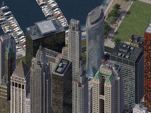
Ligne rouge du métro de Medrean City
Un article de WikiSimland 3.0.
Version du 7 juin 2016 à 23:45 par JohnRivers (discuter | contribs)
| MEDREAN CITY RED LINE | |||||||||||||||||||||||||||||||||||||||||||||||||||||||||||||||||||||||||||||||||||||||||||||||||||||
|---|---|---|---|---|---|---|---|---|---|---|---|---|---|---|---|---|---|---|---|---|---|---|---|---|---|---|---|---|---|---|---|---|---|---|---|---|---|---|---|---|---|---|---|---|---|---|---|---|---|---|---|---|---|---|---|---|---|---|---|---|---|---|---|---|---|---|---|---|---|---|---|---|---|---|---|---|---|---|---|---|---|---|---|---|---|---|---|---|---|---|---|---|---|---|---|---|---|---|---|---|---|
| Localisation | |||||||||||||||||||||||||||||||||||||||||||||||||||||||||||||||||||||||||||||||||||||||||||||||||||||
| État | Méridionie | ||||||||||||||||||||||||||||||||||||||||||||||||||||||||||||||||||||||||||||||||||||||||||||||||||||
| Ville | Medrean City | ||||||||||||||||||||||||||||||||||||||||||||||||||||||||||||||||||||||||||||||||||||||||||||||||||||
| Quartiers desservis | North Downtown South Downtown West Side Mattapan | ||||||||||||||||||||||||||||||||||||||||||||||||||||||||||||||||||||||||||||||||||||||||||||||||||||
| Gestion et exploitation | |||||||||||||||||||||||||||||||||||||||||||||||||||||||||||||||||||||||||||||||||||||||||||||||||||||
| Réseau | Métro de Medrean City | ||||||||||||||||||||||||||||||||||||||||||||||||||||||||||||||||||||||||||||||||||||||||||||||||||||
| Exploitant | MCTA | ||||||||||||||||||||||||||||||||||||||||||||||||||||||||||||||||||||||||||||||||||||||||||||||||||||
| Matériel utilisé | {{{Matériel utilisé}}} | ||||||||||||||||||||||||||||||||||||||||||||||||||||||||||||||||||||||||||||||||||||||||||||||||||||
| Caractéristiques | |||||||||||||||||||||||||||||||||||||||||||||||||||||||||||||||||||||||||||||||||||||||||||||||||||||
| Ouverture | 1938 | ||||||||||||||||||||||||||||||||||||||||||||||||||||||||||||||||||||||||||||||||||||||||||||||||||||
| Dernière extension | 2012 | ||||||||||||||||||||||||||||||||||||||||||||||||||||||||||||||||||||||||||||||||||||||||||||||||||||
| Terminus | Arlington (nord) Olympic Park (sud) | ||||||||||||||||||||||||||||||||||||||||||||||||||||||||||||||||||||||||||||||||||||||||||||||||||||
| Conduite (système) |
Manuelle | ||||||||||||||||||||||||||||||||||||||||||||||||||||||||||||||||||||||||||||||||||||||||||||||||||||
| Nombre de stations | 28 | ||||||||||||||||||||||||||||||||||||||||||||||||||||||||||||||||||||||||||||||||||||||||||||||||||||
| Longueur | 37,7 km | ||||||||||||||||||||||||||||||||||||||||||||||||||||||||||||||||||||||||||||||||||||||||||||||||||||
| Fréquentation (moyenne par jour) |
|||||||||||||||||||||||||||||||||||||||||||||||||||||||||||||||||||||||||||||||||||||||||||||||||||||
| Tracé | |||||||||||||||||||||||||||||||||||||||||||||||||||||||||||||||||||||||||||||||||||||||||||||||||||||
| |||||||||||||||||||||||||||||||||||||||||||||||||||||||||||||||||||||||||||||||||||||||||||||||||||||

| |||||||||||||||||||||||||||||||||||||||||||||||||||||||||||||||||||||||||||||||||||||||||||||||||||||
| Transports en commun de Medrean City | |||||||||||||||||||||||||||||||||||||||||||||||||||||||||||||||||||||||||||||||||||||||||||||||||||||
La ligne rouge du réseau métropolitain de la ville de Medrean City s'étend sur un parcours de 37,7 kilomètres et comporte 28 stations. Outre les correspondances que cette ligne offre avec toutes les autres lignes du réseau, le succès de la ligne rouge est surtout dû au fait qu’elle dessert de nombreux points d’intérêt sur l’ensemble du centre-ville comme le Muséum d'histoire naturelle, le parc olympique, Conelly Park ainsi que de nombreuses stations situées parallèlement à la prestigieuse Colonius Avenue.
Les trains de cette ligne circulent de 5h00 du matin à 3h00 tous les jours de semaine et de week-end.
Historique
Matériel utilisé
Correspondances
Articles connexes
- Ligne bleue
- Ligne bleue clair
- Ligne rouge
- Ligne marron
- Ligne orange
- Ligne verte
- Medrean City
- Medrean City Transit Authority
| Lignes du métro de Medrean City | | |
|---|---|---|
| |
| |
Ceci est une page du Portail des transports | |
|---|---|---|
| Découvrez les infrastructures routières, aéroportuaires, ferroviaires et fluviales de Simland grâce au portail des transports. | ||
